The Maps of San Francisco Bay from the Spanish Discovery in 1769 to the American Occupation.
1950. San Francisco: The Book Club of California, 1950.
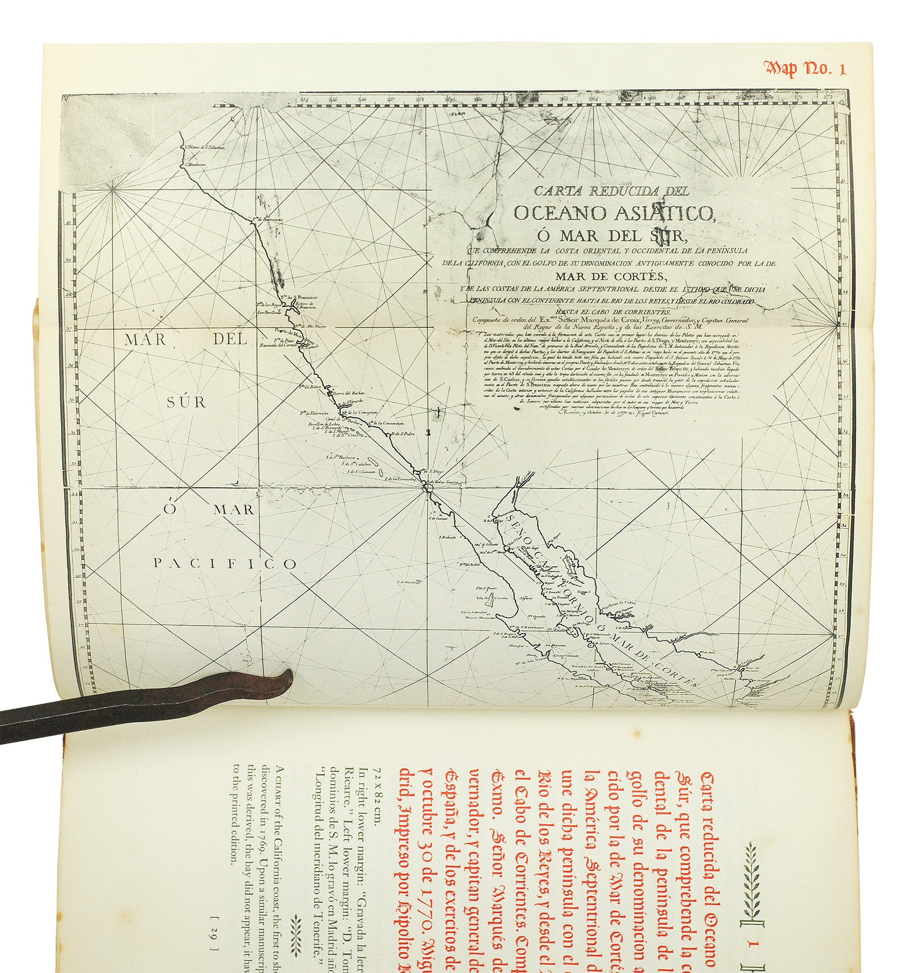
Folio, 140 pp. 39 plates, many folding. Printed in red and black. Quarter leather with decorated paper-covered boards. Tips worn, spine ends chipped, page margins foxed throughout.
§ One of 375 copies; original prospectus laid in. An important reference work from the Book Club of California containing reproductions and descriptions of 39 historically significant maps of the San Francisco Bay and of San Francisco, preceded by a 23 pp. historical account of the explorations of the area, and followed by an extensive bibliography. Item #124215
Price: $200.00
See all items in
Travel & Geography
See all items by Neal Harlow